Overview
This month, we’re bringing you a major improvement to how roadworks and traffic information is presented on the one.network map. We’re making it easier and faster for operational users, stakeholders and the public to use the map and access the information they need.
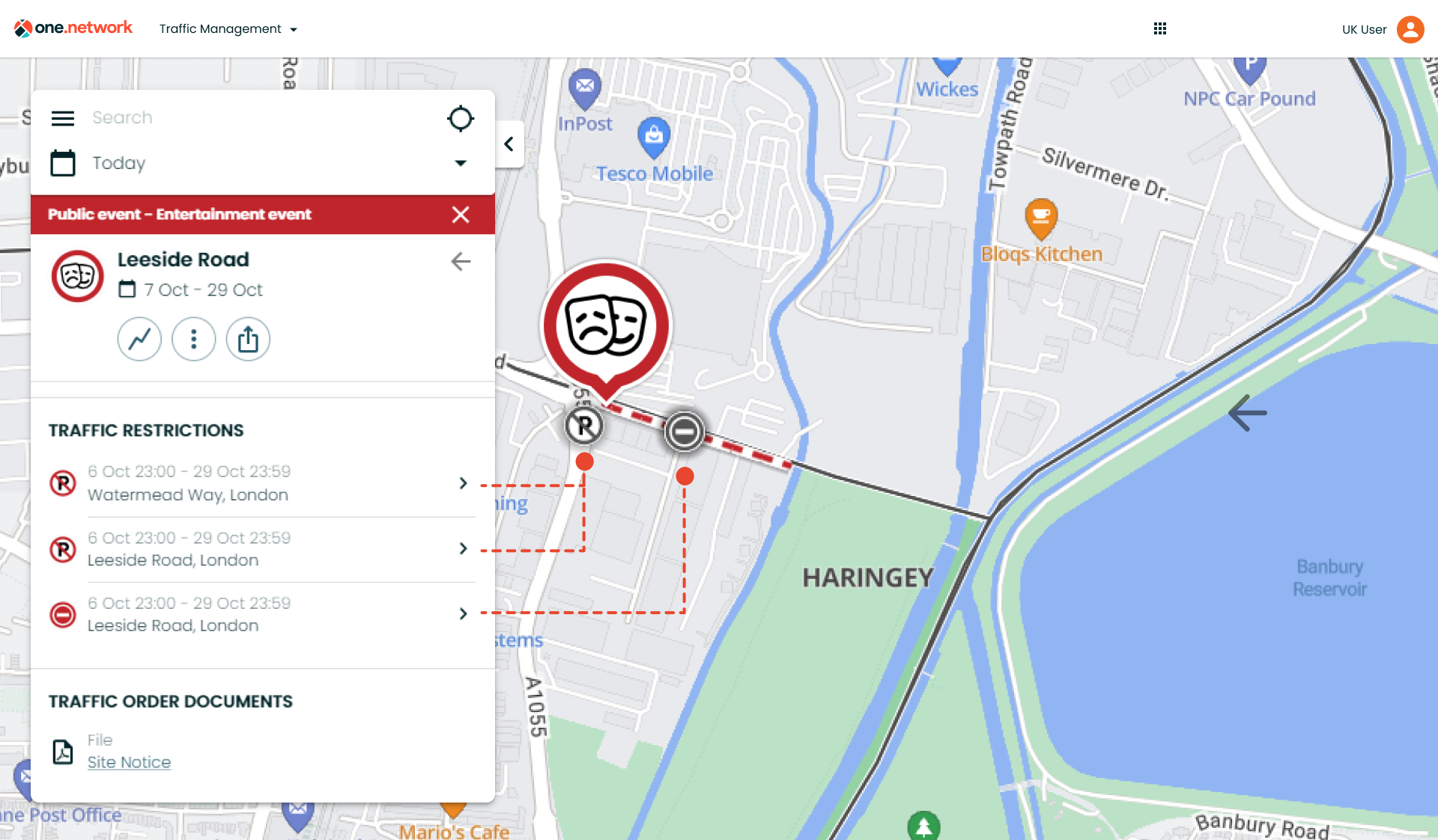
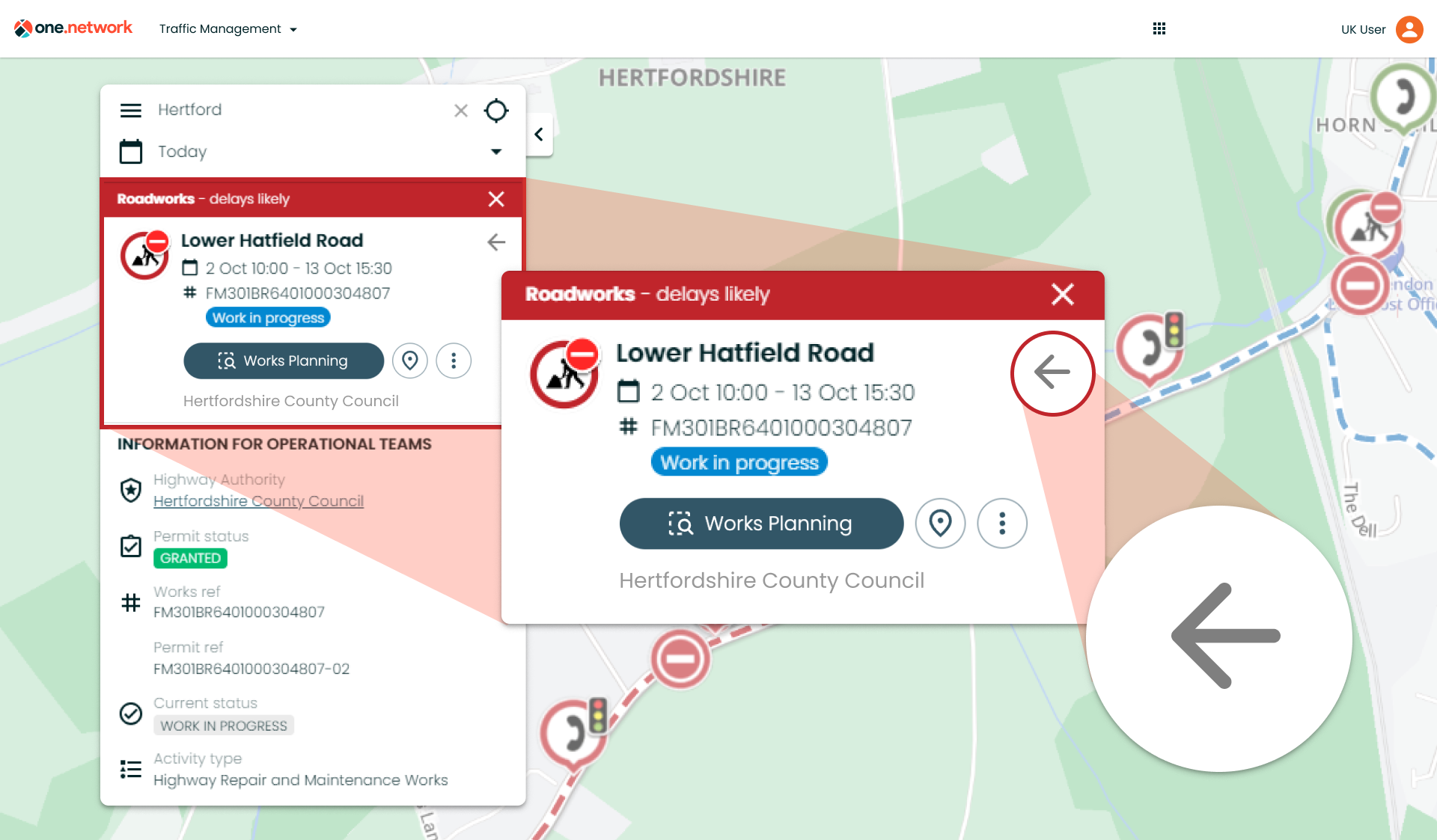
Instead of works information appearing in a ‘callout’ box next to the icon, it will now display on the left-hand toolbar, providing more space for content and a smoother map experience.
This will make coordination simpler and more efficient, allowing you to see all the surrounding and relevant road events more clearly.
To watch a quick video overview of the improvements, click here.
Below we go into further detail about the key changes.
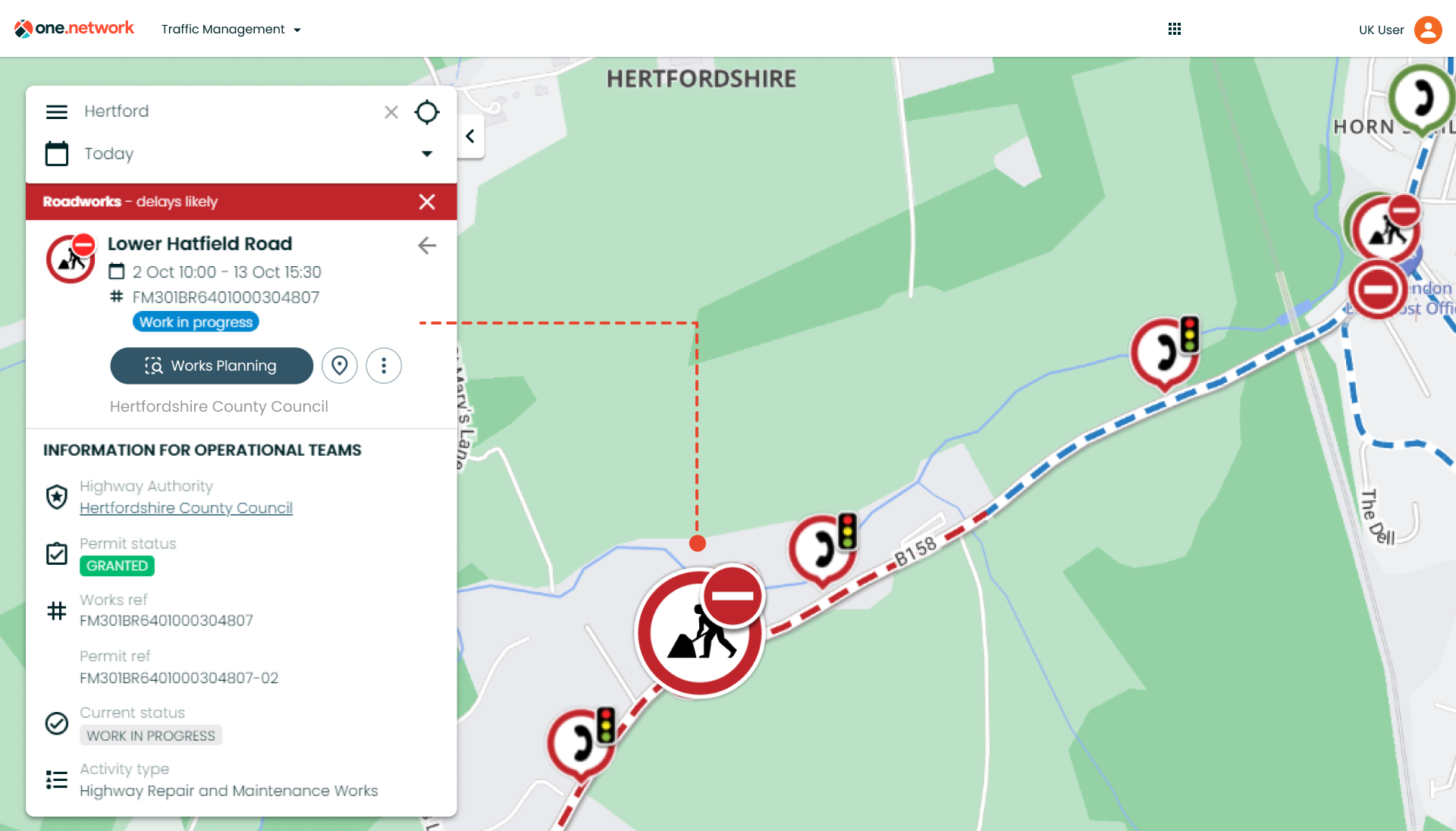
With this new layout, road event data now displays more clearly and includes standardised icons for causes and traffic restrictions, enabling faster and easier retrieval of information.
All sharing and communication options are now located under the three dots button. By clicking this, you will be able to copy and share a link to that individual road event on the one.network map via Facebook, X, or email.
The three dots button also provides the option to ‘Set map date range’ which automatically sets the date range on the one.network map to the same dates specified on the road event callout you have selected.
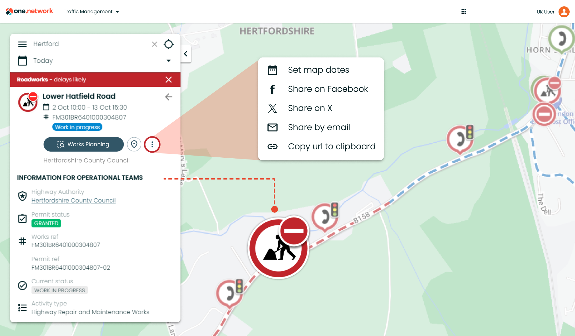
*A quick reminder! You can also set the map date range to match the road event selected by simply clicking on the calendar icon at the top of the ‘callout’.
Next is the new ‘Centre on Map’ button. If you open a callout for a road event on the one.network map but then navigate away from the area, you can now click this button to be brought directly back to the location of the road event.
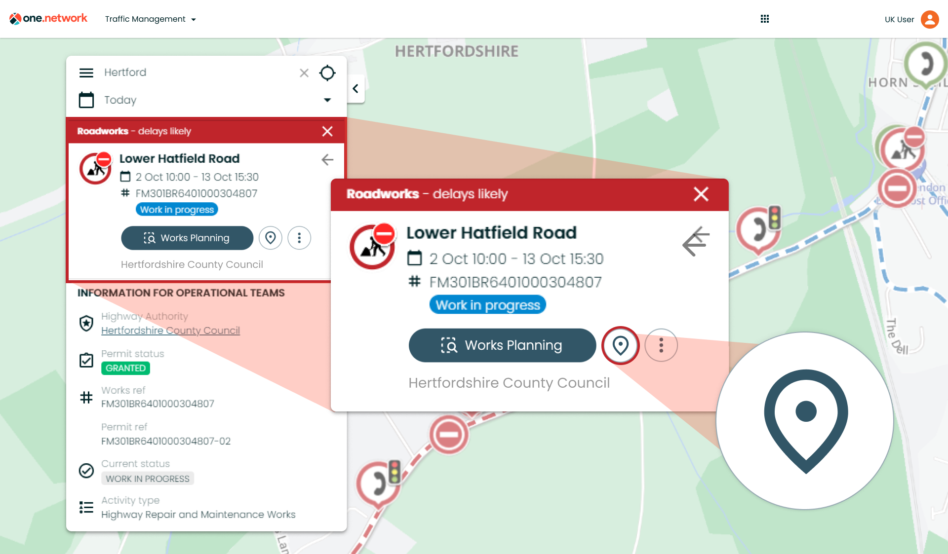
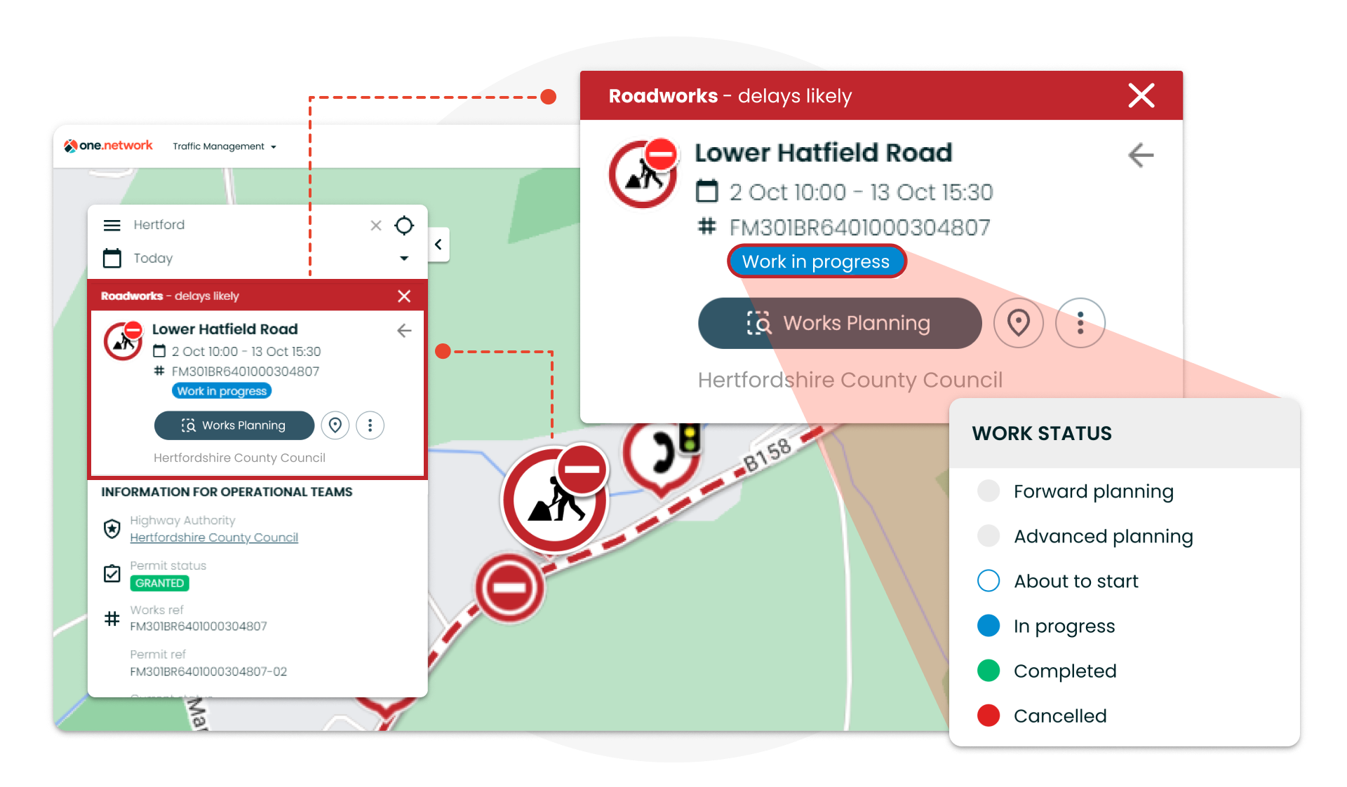
We’re also excited to introduce a new Works Planning button on the ‘callout’, providing even quicker access to our smart risk assessment tool.
Back in June, we launched a new and improved version of Works Planning and unlocked free use of the tool for all operational users and existing customers. Now, you will be able to access and use this tool straight from any permit ‘callout’ just by hitting the button.
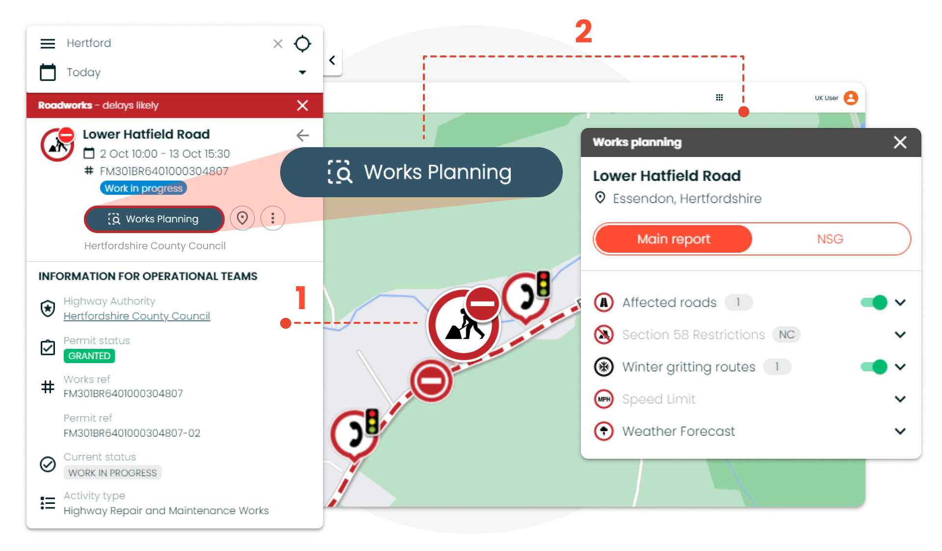
Doing this will automatically return all the relevant, crucial planning data within 200 metres of the road event. This can include built environment data, compliance information including S58s, NSG and speed limits, and proximity factors such as schools, hospitals and fire stations.
With this rapid access to Works Planning, you can now perform risk assessments and identify conflicts for existing road events even more efficiently.
Note: If you are a customer of our Traffic Management or Route Manager module, you will also be able to see quick access buttons for these modules.
The Traffic Management button will appear when you click on a traffic management plan, such as a diversion or road closure, and the Route Manager button will appear when you click on a bus route.
More key improvements to one.network callouts:
- Identifying which closures and diversions are associated with which roadworks is now simpler than ever before. When opening a works ‘callout’, any related road closures and diversions will now be highlighted on both the ‘callout’ and on the map. This will be the case regardless of which layers you have enabled and what zoom level you are at.
- Hovering over a road event on the one.network map will now show useful and relevant information, reducing the need to click and saving you time when searching the map. The data displayed includes dates, works status*, responsible promoters, reference numbers and more.
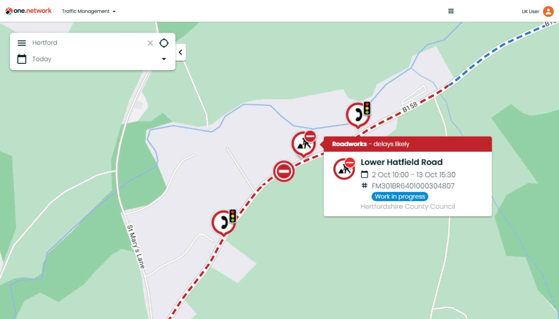
*Work Status will display whether the works are about to start, in progress, completed or cancelled. It will also highlight where works are ‘Forward Planning’ or ‘Advanced Planning’.
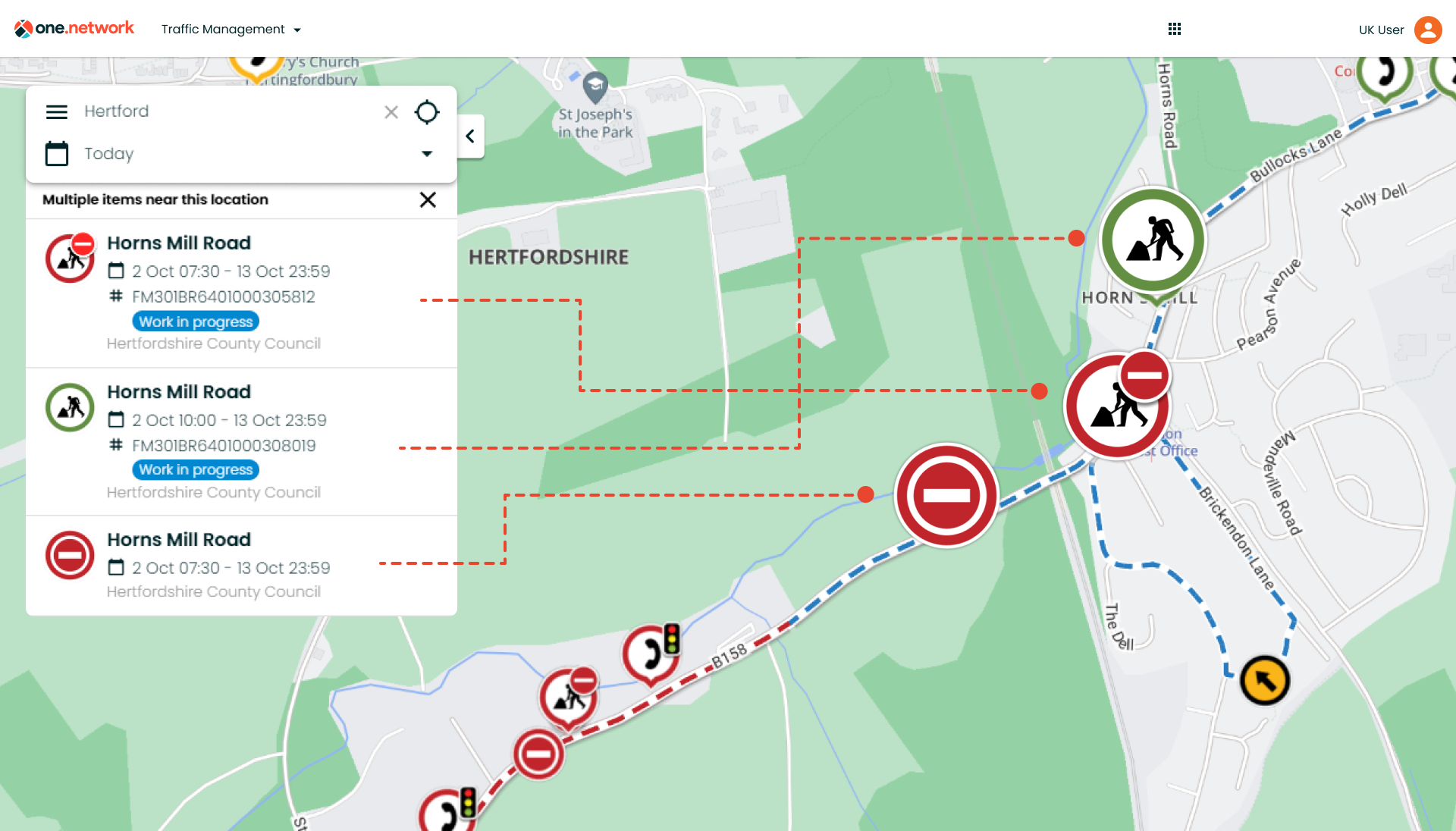
- Clicking on a cluster of road events on the one.network map, will show a list of the road events in the left-hand panel along with useful and relevant data about each event, again reducing the need to click for more information.
- The new addition of a ‘Back’ button will now allow you to skip back to the ‘callout’ for the previous road event you clicked on.
- Once a road event icon has been clicked, the ‘callout’ will stay open and visible irrespective of the map’s zoom level.
- Hovering over icons or lines on the one.network map will bolden and highlight the icon or line, making it easier to identify specific items on the map. The same applies to ‘Causes’ and ‘Traffic Restrictions’ listed on callouts.
If you have any questions on anything included in this release, please contact support@one.network.